
Disappearing Languages
The way we speak has an enormous effect on our identities. The ever-changing languages, dialects, or even accents that we use define our relationship with the world, allowing us to express concepts and ideas that might be impossible in other languages.
Iktsuarpok, for example, is an Inuit word for the feeling of anticipation when you’re expecting someone that leads you to constantly check to see if they’ve arrived, while hiraeth is a Welsh word that reflects a type of longing for the homeland or the romanticized past. The Japanese word komorebi refers to the sunlight that filters through the leaves of trees, while the Yaghan word mamihlapinatapai describes the wordless, meaningful look shared by two people who both want to initiate something, but are reluctant to do so.
Diversity of language brings an immeasurable cultural richness to the world, but the number of regular speakers of less-common languages is in steep decline. You might think this is a modern phenomenon, but linguists estimate that linguistic diversity was at its peak in 8,000 BCE, when as many as 20,000 languages may have been in existence (assuming a world population of 5-10 million and an average community size of 500-1,000). Today, it's likely that less than half of that number remain.
In the charts and maps below, we’ve investigated the languages that UNESCO describes as threatened in its Atlas of the World’s Languages in Danger. Each language is represented by a circle—with its size scaled to the number of people that speak it, and its color indicating by how endangered it is. Further down, we’ve profiled several languages in danger, and you can also calculate your nearest endangered language. Finally, there’s a map where you can explore the global distribution of these languages.
How many people speak these languages?
First, let’s look at how the size of each dot corresponds with the number of people who speak each language. Here’s a comparison of different dot sizes, and how many speakers they indicate:
There are plenty of endangered languages with fewer than 10,000 speakers that are hard to see on these bubble charts. Near the bottom of the page, you’ll find a map showing all of them.
How endangered are these languages?
UNESCO puts endangered languages into four different categories, depending on how they’re used. We’ve sorted the bubbles from above into those categories, each represented by a color. It’s worth noting that there is only a weak relationship between the number of speakers and how endangered a language is. Some languages have only a few speakers, but are less endangered than others that may be spoken by many people.
Most children speak the language, but it may be only spoken in certain places
Children no longer learn the language as mother tongue in the home
Language spoken by grandparents and older generations; while the parent generation may understand it they do not speak it to children or among themselves
The youngest speakers are grandparents or older, and they speak the language partially or infrequently
Where are these languages spoken?
We can also break down the bubble chart above into parts of the world. The charts below show how endangered languages are distributed around the world, but be careful when reading it because the size of each clump reflects the number of speakers—not the number of languages.
For example, while Asia has the biggest clump, and also the most endangered languages, the continent with the fewest endangered languages is actually Europe. Oceania has about the same number of endangered languages as Africa, but they’re spoken by fewer people so its clump is the smallest—not surprising considering most of those languages are distributed across scattered chains of tiny islands.
Languages in profile
In this section, we’ve picked out three languages that have particularly interesting stories behind them. You can also identify your nearest endangered language.
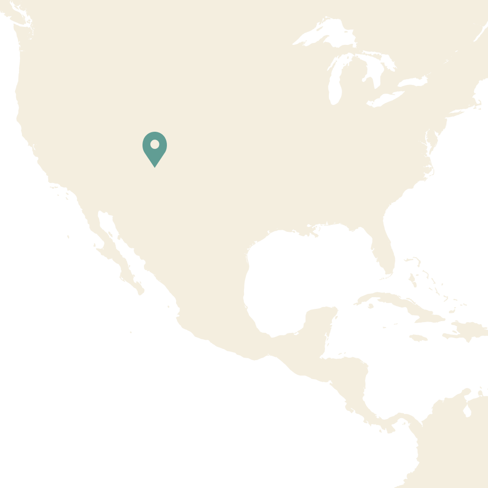
Navajo: Southwestern US
120,000 speakers remaining
The most widely spoken indigenous language north of Mexico, Navajo is part of the Na-Dené group, which linguists now believe to be connected to the nearly-extinct Yeniseian languages of central Siberia. Several hundred speakers (“code talkers”) were infamously used by the U.S. during World War 2 for encoding sensitive messages, and, post-war, a number of education programs have begun its slow revitalization. Hear it spoken.
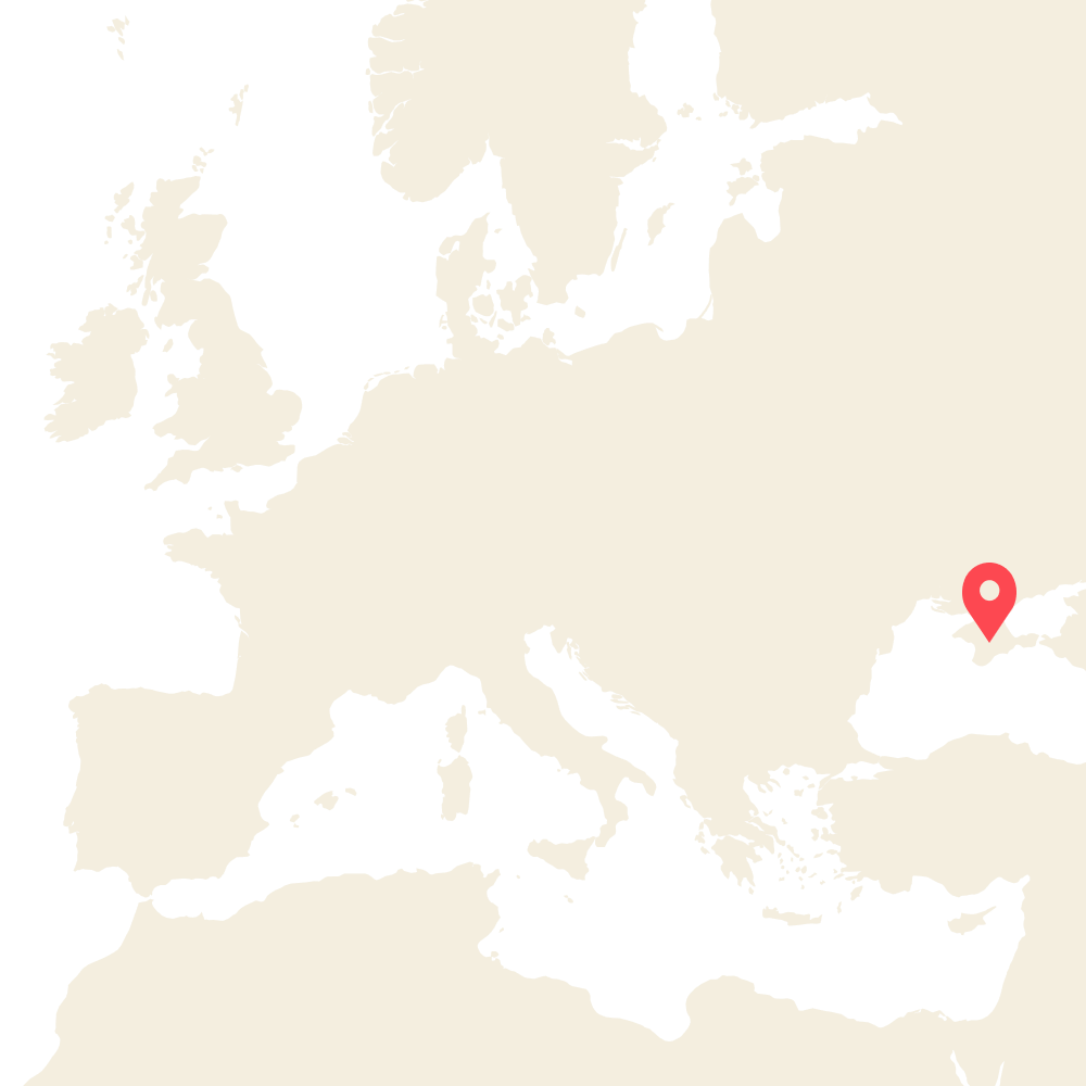
Crimean Tatar: Russia & Ukraine
100,000 speakers remaining
One of a number of languages orphaned by the advance and retreat of Mongol states during the 13th century. In 1944, Joseph Stalin and Lavrentiy Beria ethnically cleansed Crimea, forcibly transporting the majority of the region’s 220,000 Tatars to what is now Uzbekistan—and while several thousand of the community have moved back since, its language is now scattered among a small, global diaspora. Hear it spoken.
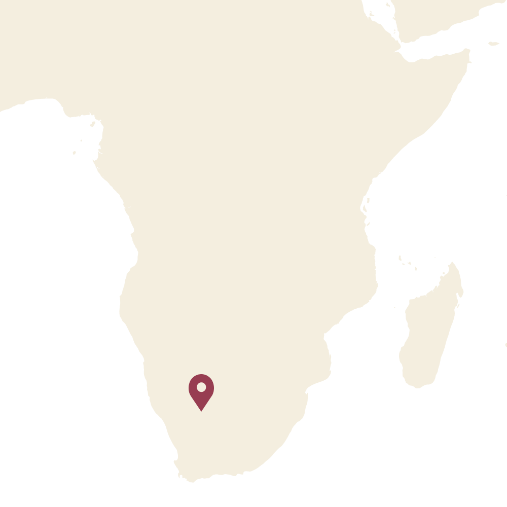
Nǀuu: South Africa
8 speakers remaining
One of the many languages of southern Africa displaced during European colonization—especially by Dutch-derived Afrikaans and Khoekhoe, one of Namibia’s national languages—Nǀuu is now rarely spoken aloud as its handful of speakers live in different villages. It is expected to die completely soon, although it will at least live on as the official motto of South Africa’s Northern Cape province, coined by 101-year-old Elsie Vaalbooi: “Sa ||a !aĩsi ’uĩsi” (“Strive for a better life”). Hear it spoken.
Find your nearest endangered language

A World of Languages
Finally, here’s every language listed as endangered in the UNESCO Atlas of the World’s Languages in Danger. You can pan and zoom the map, and click on a point to find out more about it. The color coding is the same as in the clumps above.
To read about the role that languages play in identity, be sure to check out the article that accompanies this visual essay. Plus, if you want to talk about digital identity in more detail, be sure to join our ID Question Facebook group.
This visual essay was created in D3v4.js, with TopoJSON and MapboxGL, by Duncan Geere, Eden Brackenbury and Ian Steadman for the ID Question. 2011 data from UNESCO via the Guardian. Maps from amCharts, Natural Earth and Mapbox. Icon from Smashicons. Find the source code on Github.
The ID Question is a How We Get To Next production.
How We Get To Next was a magazine that explored the future of science, technology, and culture from 2014 to 2019. Our interactives explored everything from neglected tropical diseases to government data breaches.